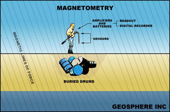
Simplified
illustration of detecting an anomaly in the Earth's magnetic field caused by
buried steel drums (in the northern United States, facing west).
A
magnetometer detects local buried iron objects because the object causes the
(locally) uniform magnetic field of the Earth to strengthen or weaken
depending on the size, orientation, and magnetic characteristics of the object.
Most of the normal field distortion is the result of an induction effect on
the earth's magnetic field by that particular iron object; however, many objects
may have a residual permanent magnetism which may interact with the induced
field, affecting the magnitude of the overall magnetic anomaly. These
variations coupled with variations in the object's orientation with respect
to the earth's field (as well as the state of corrosion of the object)
make absolute calibration for certain sized targets difficult, if not impossible.
Obtaining relative changes across the site are far more important than obtaining
absolute values. In addition, due to the weakening or strengthening effect
of the object on the (locally) uniform magnetic field of the Earth, a response
over one target produces both positive and negative distortions; such
data can yield very complicated contour maps. Oftentimes, to increase
the map's readability, these contour maps are converted to anomaly maps with
shading patterns used to distinguish two or more levels of anomaly magnitude.

On the other hand, large masses of drums may be detected easily to depths of
10-40 feet. The magnetometer can only sense ferrous materials such as
iron and steel; other metals like copper, tin, aluminum,
and brass are not ferromagnetic and cannot be located with a magnetometer
(but may be found with a metal detector).
Several different types of magnetometers are available. Some require the
operator to stop and take discrete measurements (by positioning the instrument
and pressing a button) which are compared to a base station reading; these systems
are generally proton magnetometers. Fluxgate magnetometers permit
the acquisition of data continuously as it is carried across the site.
The continuous coverage is obviously more suitable for mapping complex and large
burial sites. The effectiveness of magnetometer results can be reduced
or inhibited by interference (noise) from time-variable changes in the earth's
field and spatial variations caused by magnetic minerals in the soil or iron
debris, pipes, fences, buildings and vehicles. Many of these problems
can be minimized by careful selection of the type of instrument and field procedures
used for the survey.
For example, the gradiometer configuration (two sensors mounted vertically)
was designed to overcome large scale diurnal intensity changes in the earth's
magnetic
field; this design may also be used to minimize the lateral effects of nearby
fences, buildings, etc. Without the need for a base station, the gradiometer
permits the operator to concentrate on specific areas or targets of interest.
Because of these operational advantages, Geosphere
generally employs a highly sensitive fluxgate gradiometer system for most surveys.
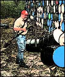
Looking
for more drums beneath the surface with the magnetometer
Magnetometers
measure variations in the magnetic field of the earth. Whether on the
surface or below, iron objects or minerals cause local distortions or
anomalies in this field. Originally designed for mineral exploration,
magnetometers are now used in the environmental field for locating buried steel
drums, tanks, pipes, and iron debris in trenches and landfills.
A magnetometer's response is proportional to the mass of iron in the
target. In a relatively "clean" area, a single drum may be theoretically
detected to a depth of 20 feet from the surface. In practice, however,
numerous smaller, near-surface iron objects will obscure the weak deeper target.
A more realistic maximum depth of detection is 5-10 feet.

email:
consultants@geosphereinc.com
124 north auburn road auburn, mi 48611 tel: (989) 662-6149
fax: (989) 662-7701
copyright ©1990-2007 geosphere inc


![]()

