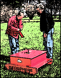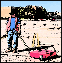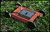


Usually the most important factors are vertical resolution and depth of radar penetration. These are achieved by using the appropriate frequency antenna (80-900 MHz). Detailed work on concrete thickness or location of buried rebar, tanks, wires, or small voids would require the 900 MHz antenna; conversely, location of deep clay layers or buried channels would require the 80-120 MHz antenna.
If lateral resolution is not critical, ie, mapping large areas for geological features, the (80-300 MHz) antenna may be towed behind a truck or 4x4 RV. The system electronics and power supplies are placed in the vehicle and connected to the antenna by a shielded cable. For critical applications, the antenna should be moved across the site by hand or a slow, steady winch system; this mode of acquisition will provide accurate locations of buried tanks, pipes, trenches and/or drums. For long profiles, the electronics may be moved on a cart with the antenna.
Geosphere's investigations using GPR are regularly done with one of Geophysical Survey Systems Inc.'s (GSSI) SIR-3 systems. The setup includes one of three antennas (120MHz, 300MHz or 900MHz) and a profiling recorder to handle the incoming radar pulses. System settings and filters are used to maximize the useful radar signals to background or geologic "noise" in the overall radar record; this includes removing unwanted static and broad-band frequency effects. Geosphere, however, limits the amount of filtering during data acquisition as unrecognized signals may inadvertently be lost.

![]()
email:
consultants@geosphereinc.com
124 north auburn road auburn, mi 48611 tel: (989) 662-6149
fax: (989) 662-7701
copyright ©1990-2007 geosphere inc


