Ground
Penetrating Radar profile showing indications of two large underground storage
tanks at a former gas station. Interpreted old soil horizons and former excavated
areas are also labeled.
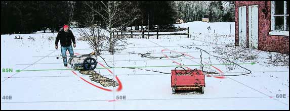
Looking
for underground storage tanks (USTs) at a former gas station using GPR. The
green line denotes the line along which the data below was collected. The two
red outlines correspond to the suspected locations of the USTs. East is to the
right.
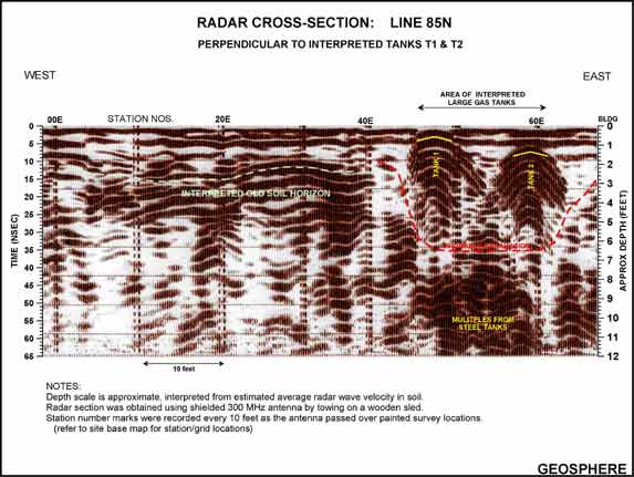
A
radar profile is a series of
radar reflection pulses stacked side-by-side in the direction of the antenna
movement. Lateral variations are clearly discernable along the length
of the graphic profile. Like seismic reflection, radar reflection events
are represented by several positive and negative pulses in the
signal. The depth of the reflector is determined by measuring the time
(in nanoseconds) between the first cross-over in the surface pulse
and the first cross-over in the target pulse; this value times the velocity
of the material yields depth. Often average velocities (or two-way
travel times) for common soil and rock types are sufficient to estimate depth
to the target reflection. If more accurate velocities are required, velocity
may be determined from a target at a known depth or special field tests made
with two antennas.

email:
consultants@geosphereinc.com
124 north auburn road auburn, mi 48611 tel: (989) 662-6149
fax: (989) 662-7701
copyright ©1990-2007 geosphere inc