![]()
email:
consultants@geosphereinc.com
124 north auburn road auburn, mi 48611 tel: (989) 662-6149
fax: (989) 662-7701
copyright ©1990-2007 geosphere inc
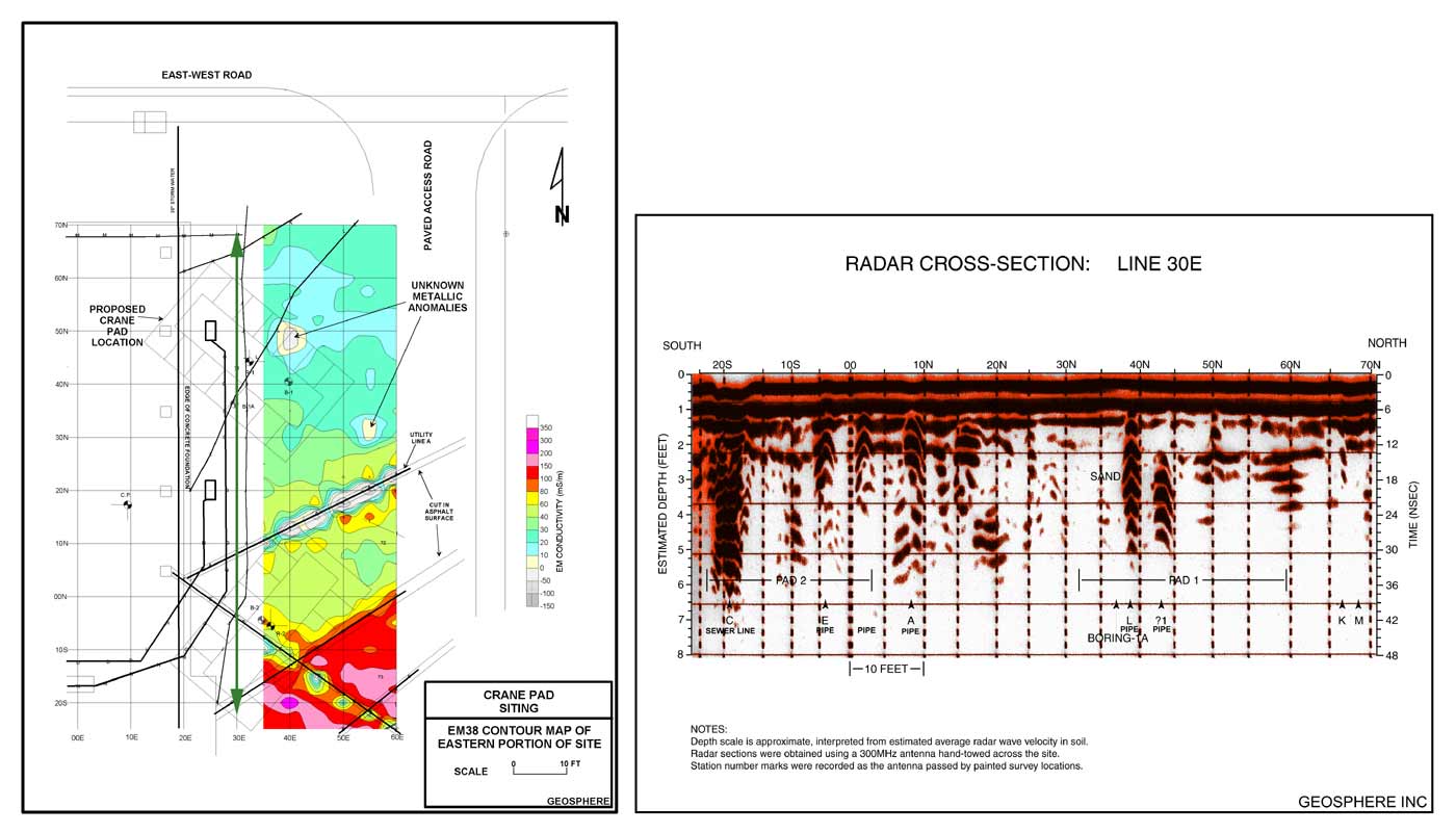
Using geophysics to map soil conditions and to accurately locate utilities at a construction site: a large construction crane required the placement of four support pads where integrity of the soils beneath could be assured. A combination of GPR and EM techniques were used to determine subsurface features.
The green line on the EM38 contour map corresponds to the GPR profile seen to the right.
![]()
email:
consultants@geosphereinc.com
124 north auburn road auburn, mi 48611 tel: (989) 662-6149
fax: (989) 662-7701
copyright ©1990-2007 geosphere inc